
 English
 Spanish
 French
 German
 Italian
 Chinese (Simplified)
 Japanese
 Korean
 Arabic
 Portuguese
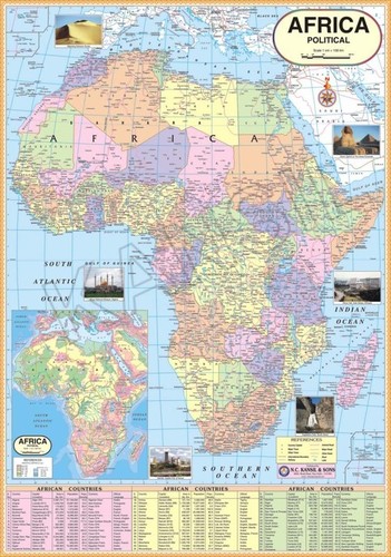
Africa Political Map
Product Details:
- Assembly Ready to hang
- Weight Approximately 120 grams
- Size Standard Wall Size
- Style Political Map
- Type Wall Map
- Material High quality paper
- Dimensions 84 cm x 56 cm
- Click to View more
X
Africa Political Map Price And Quantity
- 1 Piece
Africa Political Map Product Specifications
- Political Map
- Wall Map
- Multicolor with distinct country differentiation
- 84 cm x 56 cm
- Standard Wall Size
- Rectangular
- High quality paper
- Provides clear country boundaries and labeling, easy to read, suitable for academic use
- Ready to hang
- Suitable for all ages
- Approximately 120 grams
- Displays country borders, capitals, major cities
Africa Political Map Trade Information
- 500 Piece Per Day
- 1 Week
Product Description
Quality is our forte and we have been recognized as a leading manufacturers and suppliers of Africa Political Map. These maps are designed under the firm direction of the expert professionals using high quality papers. Our maps are used in schools and institutions for educational purposes. Available in different colors and sizes, our Africa Country Political Map is laminated with hot seal polyester film on both sides. We offer our products at the cost effective prices.
Details:
- Showing State and area border
- Political Maps
- Capital cities and important towns
- Size 70 x 100 cm
- Coloued printed on 80 gsm maplitho paper
- Laminated with hot seal polyester film on both sides
- Fitted with first quality plastic rollers at top and bottom.
- Available in English or hindi Language
Clear and Detailed Political Representation
This wall map of Africa features distinct country boundaries and clear labeling of capitals as well as major cities. The use of multicolors aids with easy country differentiation, making it an excellent educational tool for academic institutions and individuals interested in geography.
High-Quality Construction and Design
Crafted on premium paper, the map is both durable and lightweightideal for repeated handling or long-term display. The ready-to-hang design makes setup simple in classrooms, offices, or living spaces while maintaining vibrant colors and sharp details for enhanced visibility.
FAQs of Africa Political Map:
Q: How should the Africa Political Map be displayed?
A: The map is designed as a standard wall map and comes ready to hang. You simply need to select a flat wall space in your classroom, office, or home for immediate display.Q: What makes this map suitable for academic use?
A: Its clear depiction of country borders, capitals, and major cities, along with easy-to-read labeling, supports educational activities and geographical studies, making it highly beneficial for students of all ages.Q: When is this map most commonly purchased or used?
A: The Africa Political Map is frequently purchased at the start of academic terms, during geography lessons, or whenever there is a need for a comprehensive visual aid of the African continent.Q: Where can this map be effectively utilized?
A: This map is ideal for classrooms, study rooms, offices, libraries, or any space where an accurate, visual reference of Africas countries and capitals is required.Q: What is the manufacturing process for this map?
A: The map is manufactured in India using high-quality printing techniques on durable paper, ensuring lasting clarity and vibrant colors that help distinguish each country.Q: How does the color and design benefit users?
A: The multicolored design enables instantly recognizable borders between countries, facilitating easier learning and reference. The clear, bold labeling enhances readability for all users.Tell us about your requirement

Price:
Quantity
Select Unit
- 50
- 100
- 200
- 250
- 500
- 1000+
Additional detail
Mobile number
Email

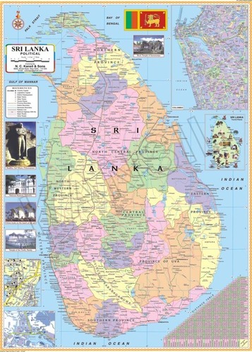
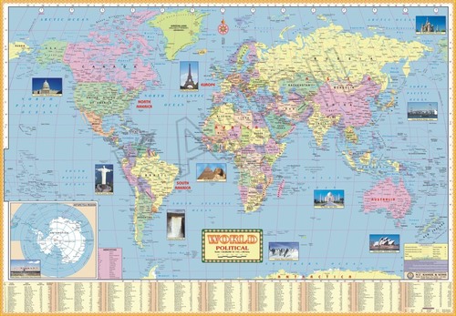
Other Products in 'Political Maps' category

- N. C. KANSIL & SONS
GST : 07AAAFN3555B1ZP - Kansil Bhawan, 8606, Model Basti,New Delhi - 110005, India
- Phone :08045479865
-


- Key Personnel
- Mr. Alok Kansil (Partner)
- Mobile :08045479865
- nck.digimkt@gmail.com
- WHAT'S APP : (+91-9310512020)
 |
N. C. KANSIL & SONS
All Rights Reserved.(Terms of Use) Developed and Managed by Infocom Network Private Limited. |
