
 English
 Spanish
 French
 German
 Italian
 Chinese (Simplified)
 Japanese
 Korean
 Arabic
 Portuguese
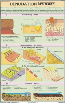
Denudation Chart
Product Details:
- Features Detailed Graphics, Durable, Easy to Hang
- Assembly Not Required
- Use Teaching/Geography Studies
- Size Medium
- Weight Lightweight
- Type Printed Chart
- Dimensions Centimeter (cm)
- Click to View more
X
Denudation Chart Price And Quantity
- 1 , , Piece
Denudation Chart Product Specifications
- Rectangular
- Illustrates Denudation Processes
- Lightweight
- Medium
- Easy to Read and Understand
- All Age Groups
- Teaching/Geography Studies
- Not Required
- Detailed Graphics, Durable, Easy to Hang
- Printed Chart
- Multicolor
- Centimeter (cm)
Denudation Chart Trade Information
- 500 , , Piece Per Day
- 5 Days
Product Description
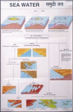
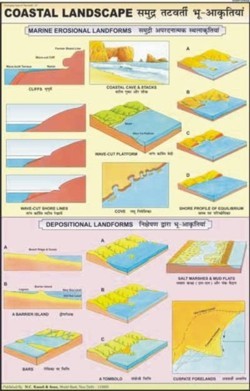
Being a quality centric approach in this domain since 1932, we have been engaged in offering a finest range of Denudation Chart. This chart is manufactured and designed using top quality basic materials and sophisticated techniques by ingenious professionals. Offered chart is highly informative in detailing about denudation in various geographical places around the world. Tested on various quality parameters prior dispatch, this Denudation Chart can be availed from us at most affordable rates.
Key Points:
- Tear resistance
- Lightweight
- Easy to understand
- Fine finish
- Available in combined language English & Hindi
- Focus weathering, chemical and physical effects of Erosion.
Comprehensive Visual Learning
This Denudation Chart features intricately detailed graphs and vibrant colors, providing a visually engaging tool for understanding complex geological processes. The clear depiction of denudation stages supports learners in grasping difficult concepts more easily during geography studies.
Built for Convenience and Durability
Designed with sturdy materials and a lightweight build, the chart is both durable and simple to display. Its medium size suits most wall spaces, while the printed graphics are resistant to fading, ensuring long-lasting utility in any learning environment.
Versatile Educational Tool
Usable by all age groups, the charts straightforward layout and explanatory illustrations make it suitable for school classrooms, home studies, or geography workshops. The easy-to-read annotations cater to various learning levels, encouraging an inclusive approach to geographic education.
FAQs of Denudation Chart:
Q: How is the Denudation Chart used in geography education?
A: The Denudation Chart serves as a visual aid in teaching denudation processes by depicting their stages and effects through detailed graphics, making lessons more interactive and easier to comprehend in both classrooms and self-study environments.Q: What makes this chart easy to read and understand for all age groups?
A: Its multicolor and clearly labeled illustrations, along with a well-structured layout, break down complex information, ensuring even young students or beginners can interpret the processes without confusion.Q: When should the Denudation Chart be introduced during geography lessons?
A: The chart is most effective when introducing or reinforcing topics related to denudation or earth surface processes, serving as a reference throughout the lesson for better retention and discussion.Q: Where can this chart be displayed for maximum educational impact?
A: It is ideal for classrooms, geography labs, study rooms, or educational exhibits. Its lightweight design and included hanging options make it suitable for various wall spaces in both schools and homes.Q: What is the process illustrated by the Denudation Chart?
A: The chart illustrates how natural forces such as weathering, erosion, and mass movement break down and remove material from the Earths surface, visually guiding learners through each stage of denudation.Q: How does the detailed graphic design benefit teachers and students?
A: The graphic-rich and color-coded format simplifies explanation and fosters engagement, enabling teachers to convey information clearly and helping students visualize and remember the denudation processes.Q: What are the advantages of choosing this chart from an Indian exporter, manufacturer, and supplier?
A: Purchasing from a reputable Indian source ensures quality craftsmanship, regional accessibility, and reliable after-sales support, with the added benefit of products crafted to meet specific educational requirements.Tell us about your requirement

Price:
Quantity
Select Unit
- 50
- 100
- 200
- 250
- 500
- 1000+
Additional detail
Mobile number
Email

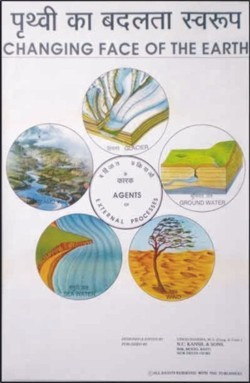
Other Products in 'Changing Face Of The Earth Chart' category

- N. C. KANSIL & SONS
GST : 07AAAFN3555B1ZP - Kansil Bhawan, 8606, Model Basti,New Delhi - 110005, India
- Phone :08045479865
-


- Key Personnel
- Mr. Alok Kansil (Partner)
- Mobile :08045479865
- nck.digimkt@gmail.com
- WHAT'S APP : (+91-9310512020)
 |
N. C. KANSIL & SONS
All Rights Reserved.(Terms of Use) Developed and Managed by Infocom Network Private Limited. |
